


ACGOS merupakan perusahaan manufacture alat geofisika dan servis di Canada. Kami MPT merupakan distributor resmi dari ACGOS untuk representative di Indonesia. Berikut adalah penjelasan mengenai perusahaan ACGOS :
terrain and climate, shallow marine EM receivers and software for wide range of onshore and offshore applications. All our data acquisition systems come fully equipped with all the necessary accessories. Besides manufacturing its own geophysical EM equipment, accessories and software, AGCOS is also an authorized dealer in North America for the top East European EM equipment and software manufacturers.

Technology Applications:
»» Oil & gas, mining, kimberlites (diamonds), groundwater and geothermal exploration
»» Geological, volcano and earthquake monitoring
»» Geological engineering, pipeline condition analysis, land reclamation and environmental studies
»» Geological, landslide, faults, melt rock, aquifer and karst mapping
»» Permafrost & glacier, deep crust & mantle research
»» Turn-key, multifunction, high precision EM data acquisition systems for all known ground
electroprospecting techniques
»» All terrain, all climate, all season technology
»» Supports 18 main ground electroprospecting methods
»» No external devices needed to carry out field data acquisition
»» Interchangeable electric & magnetic channels
»» Flexible sampling rates
»» Individual gain for every channel
»» Individual recording time selection for each frequency band
»» Portable, compact, lightweight
»» Ideal instrument for universities, research organizations, geophysical contractors, mining, oil & gas,
geological engineering, ecological and archeological companies
»» First company to introduce wide spectrum of precision field tripods for magnetic sensor installation on any terrain or climate which significantly increases accuracy and productivity in the field
»» Know-How environmentally friendly shallow marine EM (coastal shelf and transition zones) technology for oil and gas exploration
»» New environmentally-friendly electroprospecting technique for mining exploration Multifrequency Magnetovariational Profiling method (MVP) which allows to target drilling during the course of the field survey and to estimate parameters of the anomaly in the field without carrying out inversion

"Electroprospecting Technology Capabilities & Resolved Tasks"
»» Method dependent, from 0 to 150 000 meters
Turn-key Broadband Multifunction EM Data Acquisition System consisting of EM receivers, channels, survey accessories for 18 well known ground electroprospecting methods allows to successfully solve the following tasks:
»» Mining exploration
»» Kimberlites (diamonds) exploration
»» Groundwater exploration
»» Oil & gas exploration
»» Geothermal exploration
»» Geological mapping
»» Landslide mapping
»» Faults mapping
»» Melt rock mapping
»» Aquifer mapping
»» Karst mapping
»» Geological engineering studies
»» Pipeline condition analysis studies
»» Land reclamation studies
»» Environmental studies
»» Geodynamic investigations
»» Archaeological investigations
»» Dike and sills investigations
»» Ecological investigations
»» Geological monitoring
»» Volcano and earthquake monitoring
»» Permafrost & glacier research
»» Deep crust & mantle research
Supported Electroprospecting
Methods Natural Field EM:
Direct:
»» Self-Potential (SP)
Alternating:
»» Audiomagnetotellurics (AMT)
»» Magntetotellurics (MT)
»» Low Period Magnetotellurics (LMT)
»» Magnetovariational Profiling (MVP)
»» Telluric Currents (TC)
Control Source EM:
Quasi Direct Current:
»» Resistivity:
»» Electrical Profiling (EP)
»» Vertical Electric Soundings (VES)
»» Dipole Electic Soundings (DES)
»» Electrotomography (ET)
»» Induced Polarization (IP):
»» Time-Domain (TDIP)
»» Frequency Domain (FDIP - Amplitude)
»» Frequency Domain (FDIP - Phase)
»» Spectral IP (SIP)
»» Misse-a-la-Masse
Alternating Current:
»» CSAMT
»» CSMT
»» VLF
»» Frequency Domain EM Soundings (FDEMS)
»» Induction Profiling (IEP)
»» TDEM (FasTEM / LowTEM / MulTEM)
Broadband Multifunction EM Receivers Gepard-4 & Gepard-8

Description:
All-in-One multifunction geophysical EM data acquisition systems Gepard-4/8 are intended for sensitive and accurate registration of electrical and magnetic fields in wide frequency and dynamic range with interchangeable electric and magnetic channels, individual gain selection for each channel, both in natural source and control source modes and wide exploration depth intervals. System works with a variety of sensors, including grounded and non-grounded electric lines, high frequency and long period induction coil magnetic sensors, fluxgate magnetometers, aircoils and airloops. Flexible configuration of electrical and magnetic channels allows to increase productivity in the field and collect data sets for several methods and sites with one geometrical field layout.
Main Features:
»» All-in-One System - Time and Frequency Domain ground EM data acquisition
»» Stand-Alone System - no external devices (PC, tablets, etc.) needed to carry out field data acquisition
»» Field Survey Capabilities:
Natural Source: SP, AMT, MT, LMT, MVP, TC
Control Source: EP, VES, DES, Electrotomography, Misse-a-la-masse, TDIP, FDIP (Amplitude &
Phase), SIP, CSAMT, CSMT, VLF, FDEMS, IEP, TDEM
»» 24-bit geophysical EM data acquisition
»» 8 independent channels (electric or magnetic, flexible configuration)
»» 43,000 to 0.0001 Hz effective frequency band
»» Flexible sampling frequencies / operator defined
»» On-screen data processing and results viewing
»» High-speed data transfer modes
»» GPS and cable synchronization options
»» Unlimited number of channels/receivers in data acquisition system
»» Intuitive Hi-Res color touchscreen GUI
»» Manual and Automatic operation modes
»» Portable, lightweight
Broadband Current Source AT-100

Description:
AT-100 is lightweight, compact and portable broadband geophysical current source with wide range of the output frequencies and currents, allowing large variations of the load impedances.
Main Features:
»» Stand-Alone System - no external devices (PC, tablets, etc.) needed to carry out field DAQ
»» Field Survey Capabilities: EP, VES, DES, Electrotomography, Misse-a-la-masse, TDIP, FDIP (Amplitude & Phase), SIP, CSAMT, CSMT, VLF, FDEMS, IEP, TDEM
»» Stabilized output current up to 1A for driving inductive loads or grounded dipoles
»» Maximum power output - 100W / 400V
»» Output waveform - square wave, 100% & 50% duty cycle
»» Broadband output - 50kHz to 0.01Hz
»» Intuitive Hi-Res color touchscreen GUI which allows real-time parameters monitoring
»» GPS and cable synchronization options
»» Manual and Automatic operation modes
»» Powered by 12V external battery
»» Portable, lightweight
Output Frequencies (Hz):
»» Band 1: 43690.7, 21845.3, 10922.7, 5461.33, 2730.67, 1365.33, 682.667, 341.333, 170.667, 85.3333, 42.6667, 21.3333, 10.6667, 5.33333, 2.66667, 1.33333, 0.66667, 0.33333, 0.16667, 0.08333, 0.04167, 0.02083, 0.01042
»» Band 2: 40000, 20000, 10000, 5000, 2500, 1250, 625, 312.5, 156.25, 78.125, 39.063, 19.531, 9.7656, 4.8828, 2.4414, 1.2207, 0.6104, 0.3052, 0.1526, 0.0763, 0.0381, 0.0191
»» Band 3: 32768, 16384, 8192, 4096, 2048, 1024, 512, 256, 128, 64, 32, 16, 8, 4, 2, 1, 0.5, 0.25, 0.125, 0.0625, 0.03125, 0.01563
»» Band 4: 54591.5, 27295.7, 13647.9, 6823.94, 3411.97, 1705.98, 852.992, 426.496, 213.248, 106.624, 53.312, 26.656, 13.328, 6.664, 3.332, 1.666, 0.833, 0.4165, 0.20825, 0.10413, 0.05206, 0.02603, 0.01303
»» Band 5: 49152, 24576, 12288, 6144, 3072, 1536, 768, 384, 192, 96, 48, 24, 12, 6, 3, 1.5, 0.75, 0.375, 0.1875, 0.09375, 0.04688, 0.02344, 0.01172
Sensors of EM Field

Low Noise Non-Polarizing Electrodes:
To measure the electric component of the EM field, grounded electric lines of 5-100m are used. E-Lines are grounded using low-noise non-polarizing electrodes. Large effective area of the special form membrane allows for low resistance grounding resulting in high-quality measurements. Low noise and high stability, light weigh and compact design, simple and convenient to use and maintain and are easy and quick to refill. Electrodes are manufactured on the basis of copper, lead, and silver:
»» ACE-84 (copper)
»» ALCE-84A (lead)
»» ASCE-84AG (silver)
Induction Coils:
For methods using EM field frequency domain, induction coils have been used over the past two decades as
EM field sensors. Two sensors of different construction cover the entire frequency range of the exploration:
»» AMS-15 - frequency range 50,000 to 1Hz
»» AMS-37 - frequency range of 500 to 0.0001Hz
The sensors are hermetically sealed and can be buried underground, however a more effective installation is via specialized precision field tripods.
Aircoils and Airloops for TEM/TDEM
To measure the derivative of the vertical component of the magnetic induction by time, airloop sensors equipped with a preamplifier are used:
»» FTEM-100 - diameter of the frame for FastTEM is 60 cm (50 turns)
»» MTEM-200 - diameter of the frame for MulTEM is 1m (100 turns)
»» LTEM-25 - square loop for Low TEM is 25 x 25m (50 turns)
Precision Field Tripods for Induction Coil Magnetic Sensors

Precision field tripods from AGCOS are especially designed to minimize magnetic sensor alignment errors to all three axis - X, Y and Z, and to increase productivity of field work by significantly reducing time required for sensor installation. You can now throw your augers and shovels away and install sensors in less than 5 minutes on any soil, any terrain and any climate. AGCOS presently manufactures six models of precision field tripods:
»» TRI-1/30 & TRI-1/50 - single component tripods for installation of vertical magnetic sensors (AMS-15 & AMS-37) respecively
»» HTRI-1/30/1 & HTRI-1/50/1 - single component tripods for installation of horizontal magnetic sensors (AMS-15 & AMS-37) respecively
»» TRI-3/30 & TRI-3/50 - three component tripods for installation of Hx, Hy and Hz magnetic sensors

Main Advantages:
»» Significant increases to accuracy and productivity in the field
»» Ability to carry out measurements on any terrain or soil conditions where burying sensors into the ground is physicaly not possible
»» When assembled, tripods align sensors orthogonally to each other with an error of less than 0.5 °
»» Levels mounted on the tripod allow the user to install sensors quickly and precisely in vertical (axis Z) and horizontal (axis X and Y) positions
»» Tripods could be disassembled and prepared convenient for transportation, storage and moving to another site with sensors and cables in the backpack
»» Tripods are made of 100% nonmagnetic anticorrosive nonconductive high-quality materials with minimal use of nonmagnetic metals
»» Tripods are made in three modifications: A, B and C, which have different accuracy of axis alignment (1.0°, 0.1° and 0.01°)
Marine EM Receivers
Marine EM receivers 2AUSS-07A, 5AUSS-07A and SMMT are designed to carry out shallow marine EM surveys in transition zones and coastal shelf at depths of up to 200m. They are based on high-precision and highly-sensitive land geophysical equipment for electroprospecting surveys and are built in such a way, that equipment can easily be used for land surveys or for simultaneous marine and land EM data acquisition as well.

Main Advantages:
»» Ability to deploy and retrieve systems from small vessels
»» Registration of two components of electric and/or three components of a magnetic field
»» GPS synchronization of each receiver
»» Unlimited number of receivers working in a system
»» Use of land based remote reference site for noise correction
»» Digital data recording method to a solid-state detachable memory
»» Underwater enclosures for receiver and power source with quick access
»» System data logger with digital compass, inclinometer, pressure sensor, temperature and humidity sensors
»» Multistage, primary and emergency retrieval systems

Technology Applications:
Marine EM systems are intended for oil & gas exploration, monitoring, earthquake research, and other environmental and geophysical applications. MT technology is also widely used in scientific research, such as the study of the deep structure of the earth’s crust and upper mantle.
Software for Data Analysis, Processing, Visualization and Interpretation
Electrotomography & VES:
»» ZondIP1D - VES and VES-IP 1D data interpretation
»» ZondRes2D - Resistivity + IP 2D data interpretation (versions Land, Marine, Borehole)
»» ZondRes2Dp - Resistivity + IP 2D data interpretation in polygonal way (versions Land and Borehole)
»» ZondRes3D - Resistivity + IP 3D data interpretation (versions Land, Marine, Borehole)
»» ZondCHT - Resistivity, IP and EM loging 2D data interpretation (specialized for borehole
measurements)
Electromagnetic Sounding:
»» ZondHED1D - VES 1D data interpretation with induction effect calculation
»» ZondMT1D - MT (AMT, RMT) 1D data interpretation
»» ZondMT2D - MT (AMT, RMT) 2D data interpretation
»» ZondVMD1d - FDEM sounding with vertical magnetic source dipole 1D data interpretation
»» ZondTEM1D - TDEM sounding 1D data interpretation for source loop and electric dipole
»» MT-Corrector - Magnetotelluric postprocessing software
Seismic Tomography, Gravity, Magnetic, Self-Potential Methods & Utilities:
»» ZondST2D - Seismotomography 2D data interpretation
»» ZondST3D - Seismotomography 3D data interpretation
»» ZondGM - new product for 2D gravity and magnetic data interpretation
»» ZondMag2D -2D gravity and magnetic data interpretation (versions Ground, Airborne)
»» ZondMag3D - 3D gravity and magnetic data interpretation
»» ZondPGM - 2D gravity and magnetic data interpretation in polygonal way
»» ZondSP2D - 2D electric self-potential data interpretation
»» ZondSP2Dp -2D electric self-potential data interpretation in polygonal way
»» BHEditor - Software for lithologic columns creation
»» SectionEditor - Software for geological/geophysical section creation
»» Z3DModView - Software for 3D visualization of 2D inversion results
»» ZCGViewer - calculation and visualization of electric resistivity profiling graphic maps and apparent resistivity maps (for different arrays)
»» ZondProtocol - ERT, protocols, quality control, preparing data for inversion
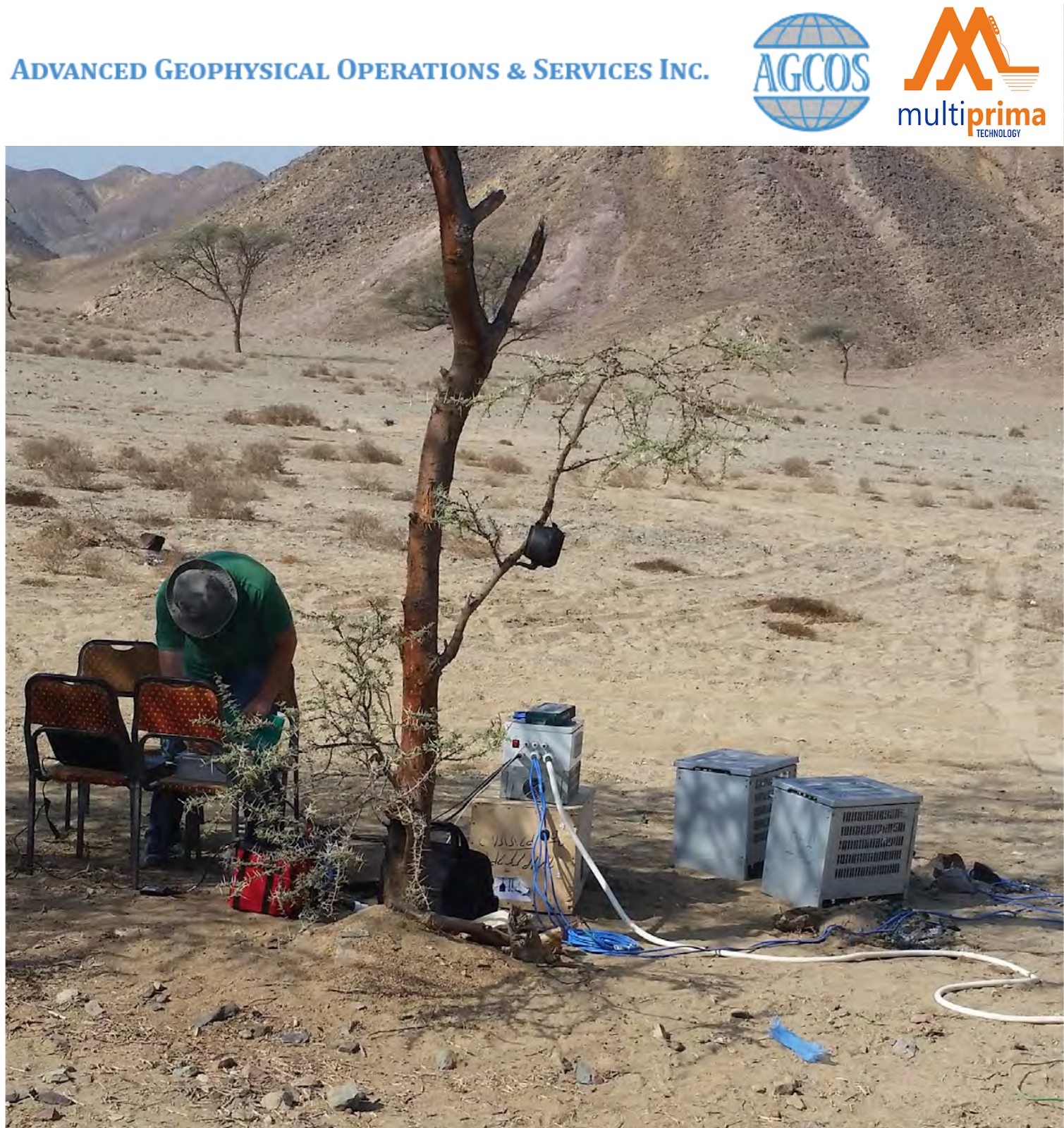
Examples of Field Works :

Study Case Results of gold exploration survey in Chukotka, Russia


